Landscape Design / Accessibility
Accessible Public Space Plan for the Wuyi Commercial District
A public-space renewal proposal connecting transit, pedestrian flow, tactile paving, pocket landscapes, and night-time wayfinding in central Changsha.
PDF 1, 3, 5-13, 15-17, 19-27, 29-32, 37-42, 44-45
Process pages, appendices, and acknowledgements
Project Thesis
Accessibility is treated as a district-wide public-space network, not a collection of isolated facilities.
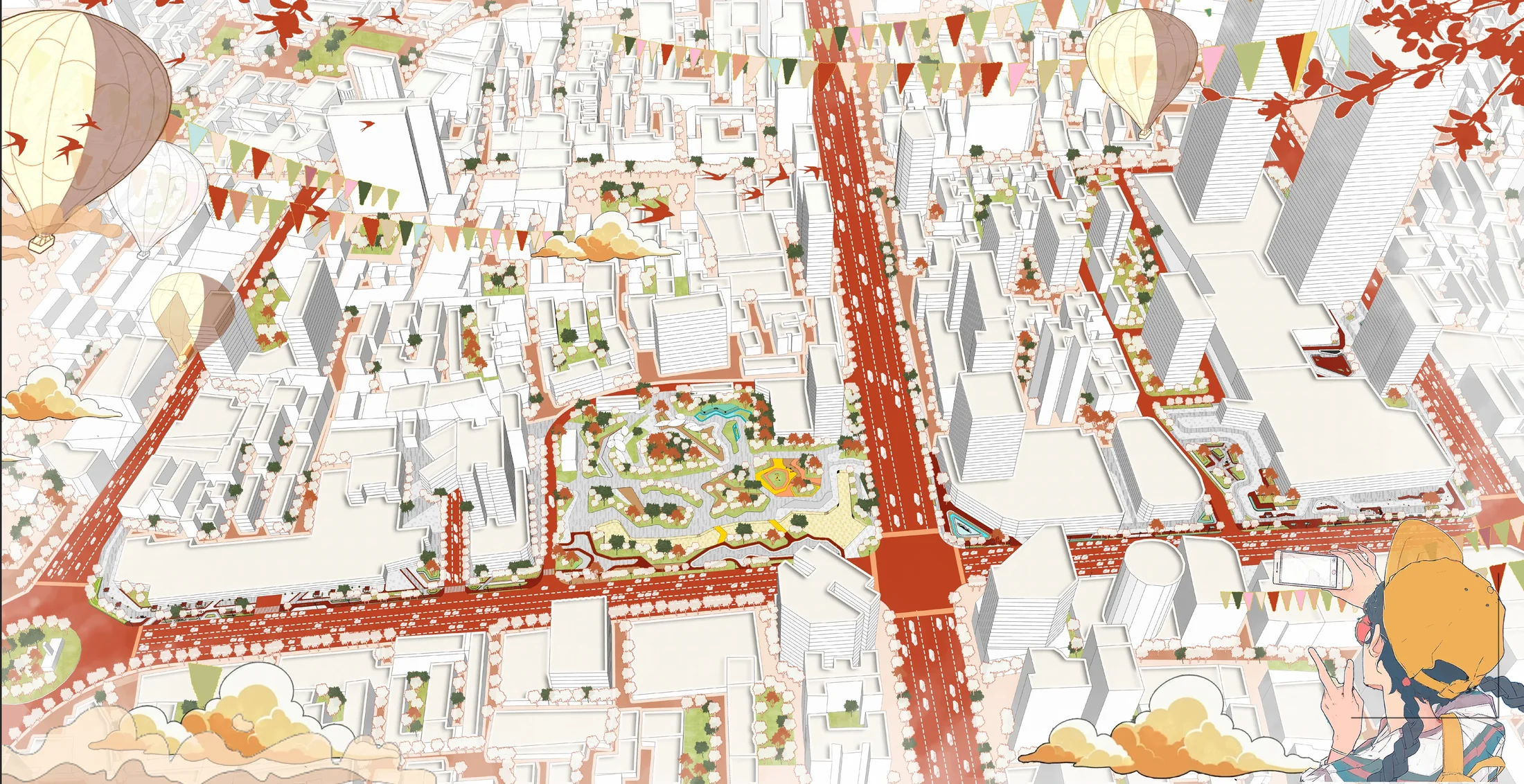
The project studies approximately 17 hectares of public space in central Changsha. Metro entrances, bus stops, commercial edges, pocket landscapes, squares, lighting, and wayfinding are reorganized as one connected pedestrian system.
The web case study restructures the original project boards into a readable archive, moving from context and diagnosis through positioning, masterplanning, key nodes, and the accessibility strategy.
01 Project Overview
Renewing a commercial district at the historic center of Changsha
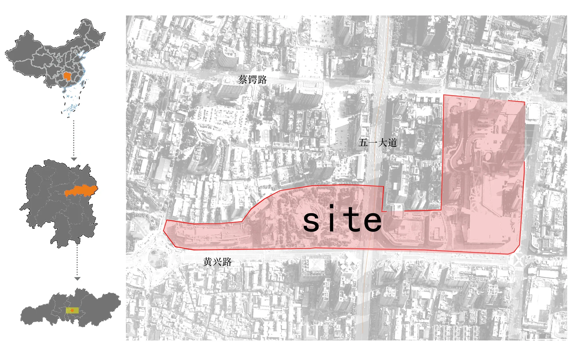
The Wuyi commercial district sits at the junction of Furong and Tianxin districts and forms one of Changsha’s most active commercial centers.
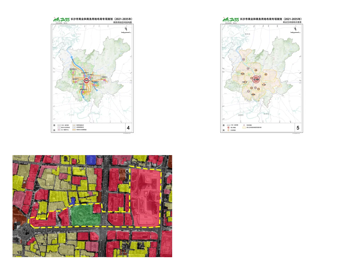
Planning policy identifies the area as both a primary commercial center and an integrated transport hub, combining retail, finance, culture, and mobility.
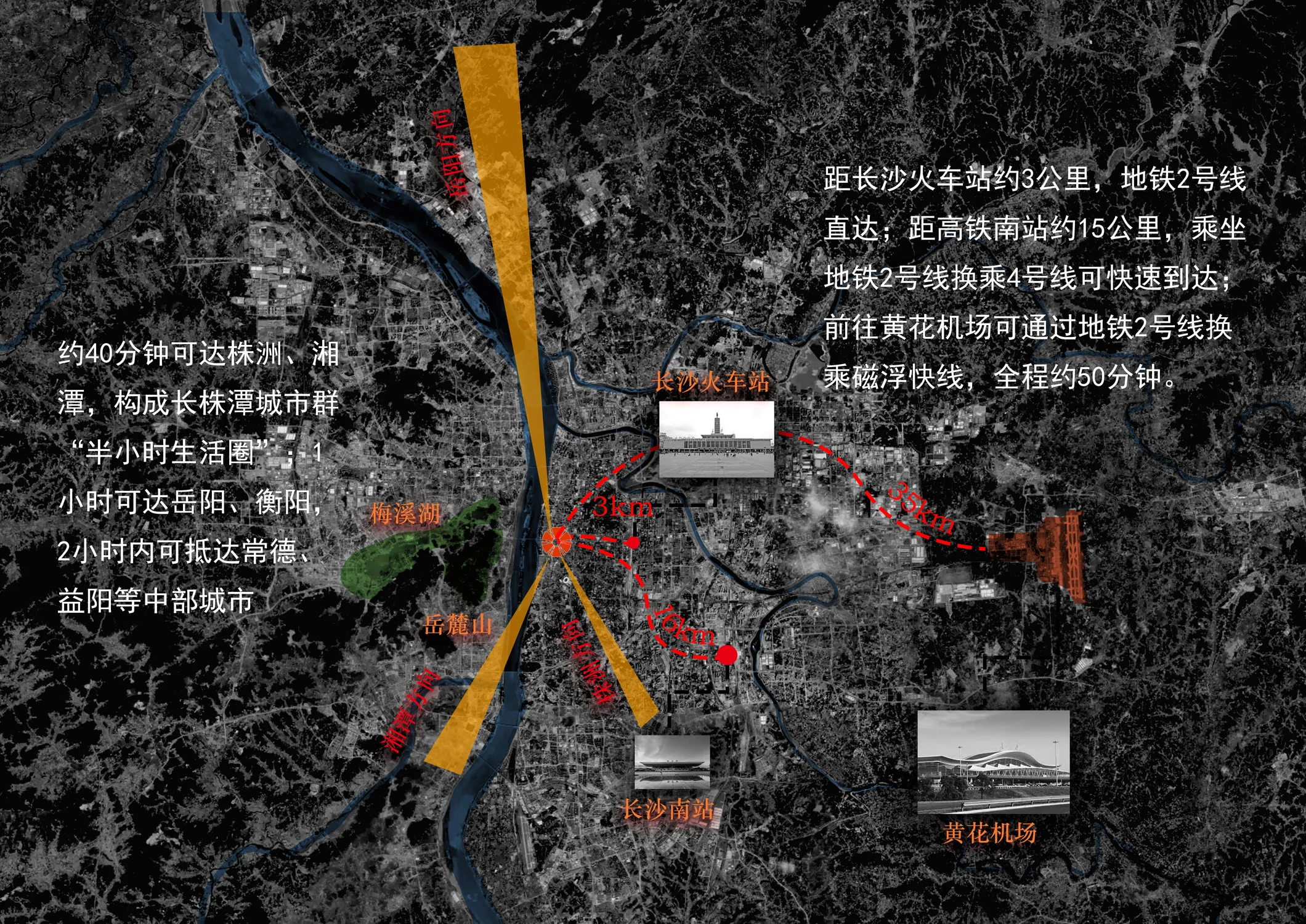
Metro lines, major streets, the Xiang River waterfront, and surrounding landmarks make the district a layered node of commuting, tourism, consumption, and everyday public life.
02 Existing Analysis
Reading blocks, pedestrian flow, transit, and accessibility as one urban network
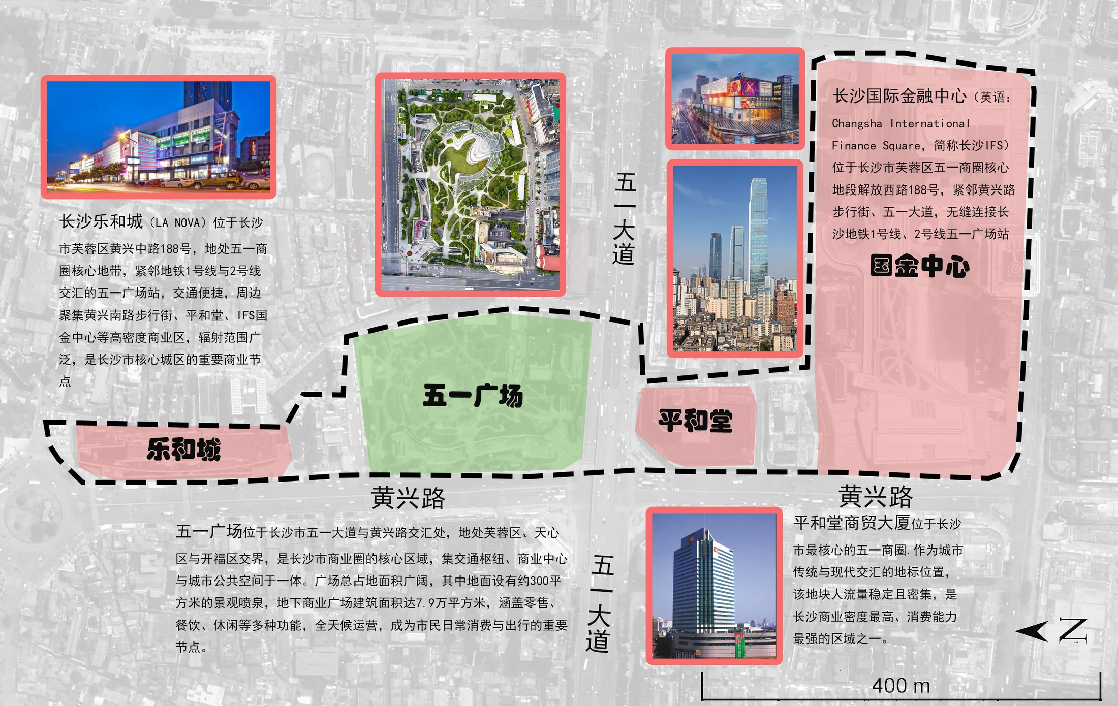
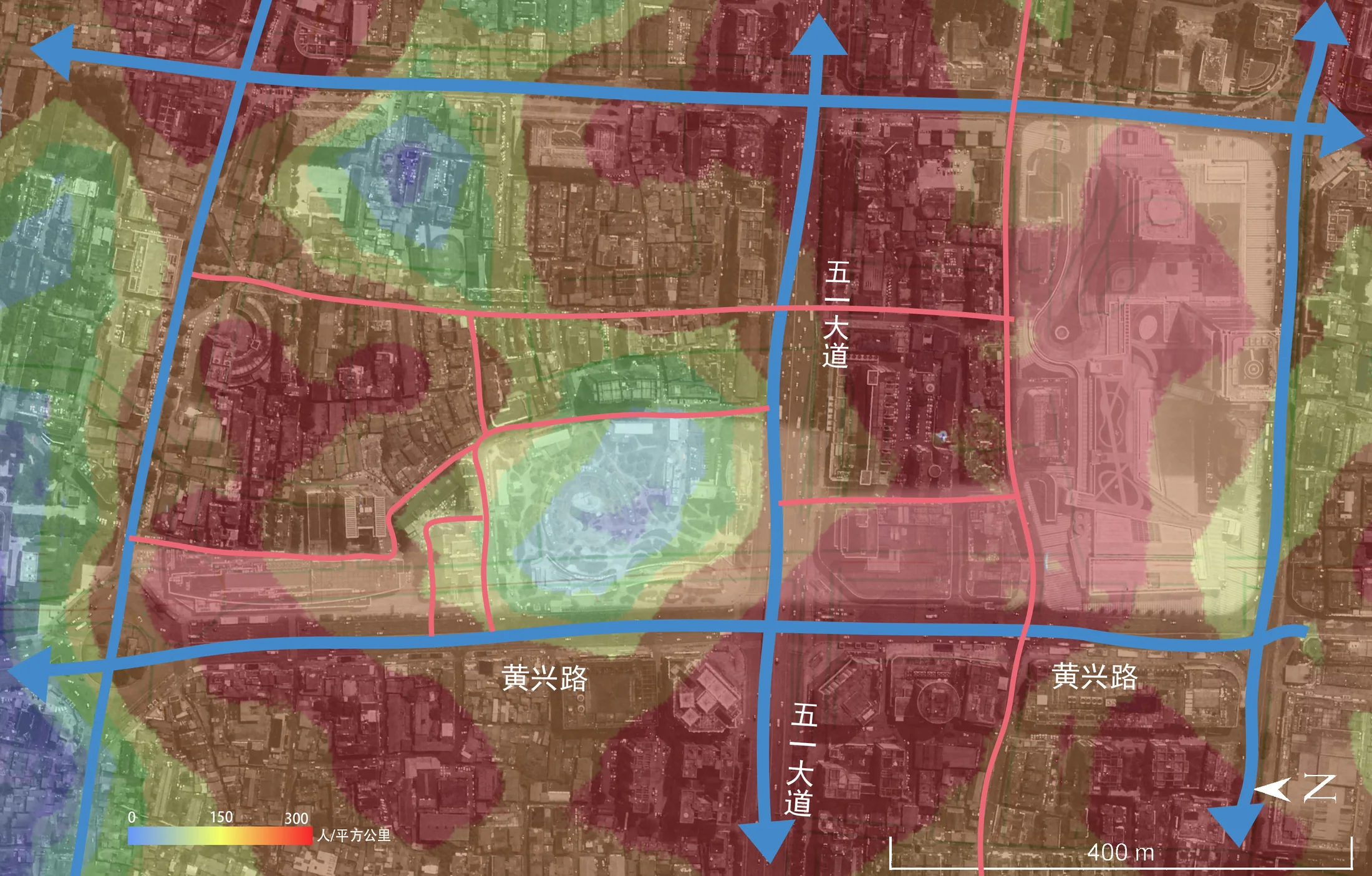
Wuyi Square, IFS, major department stores, green spaces, metro entrances, and street edges overlap within an intensely used public realm.
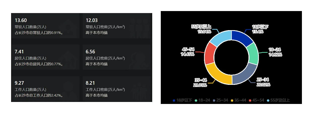
The district combines a stable residential and employment base with exceptionally high visitor turnover, functioning as both a neighborhood and a metropolitan destination.
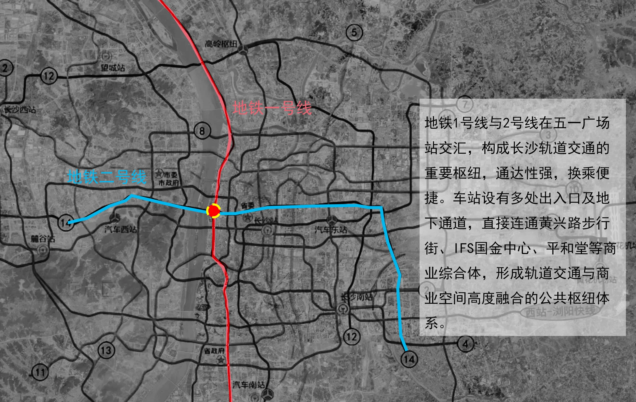
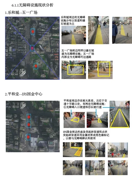
Metro Lines 1 and 2 meet at Wuyi Square, yet transfers between transit, buses, commercial entrances, and ground-level public space lack a coherent accessible route.
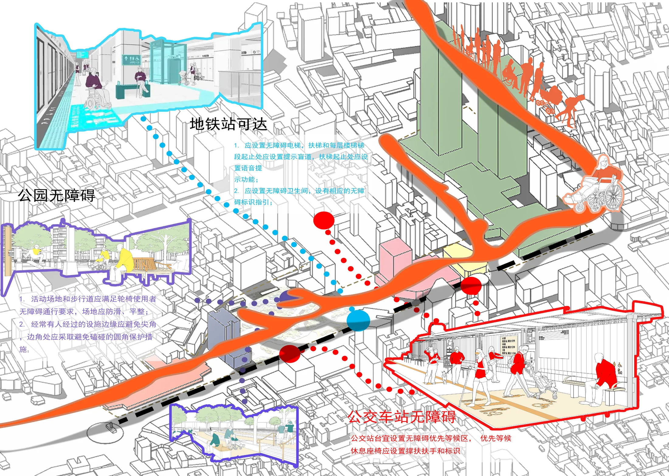
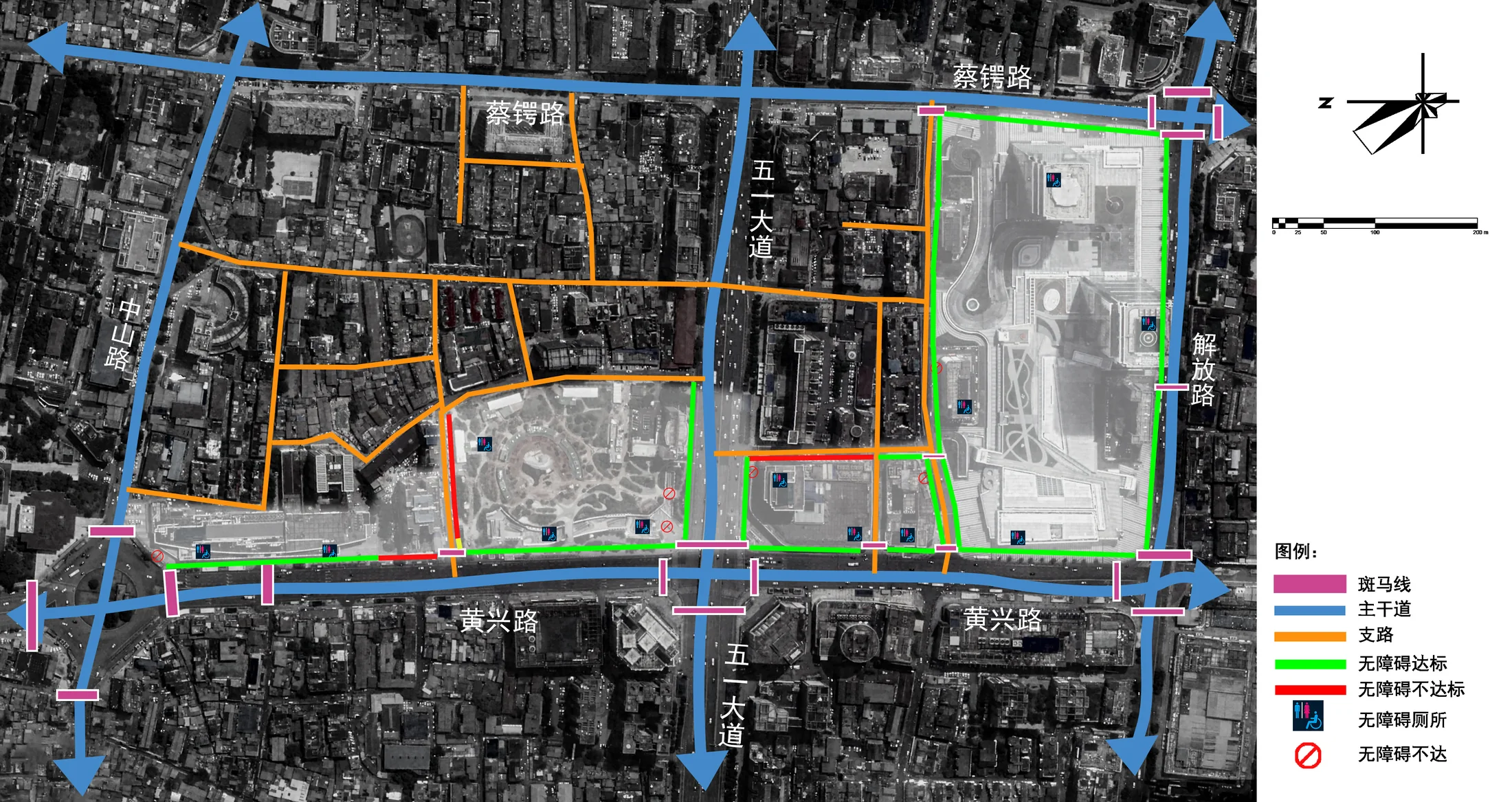
The audit identifies insufficient facilities, tactile paving placed too close to traffic or crowded crossings, and routes interrupted by utilities and street obstacles.
03 Design Positioning
Combining commercial energy, cultural identity, green pauses, and continuous access
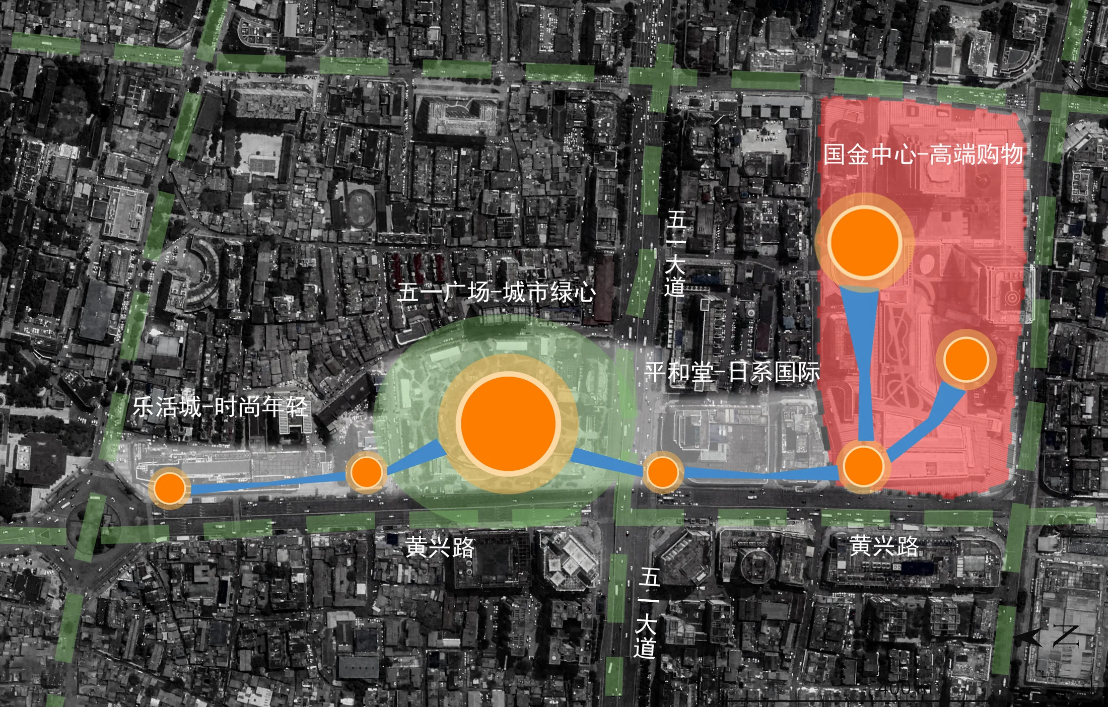
The design focuses on Wuyi Square, IFS, and the connecting street network, treating commerce, culture, and accessible movement as parallel priorities.
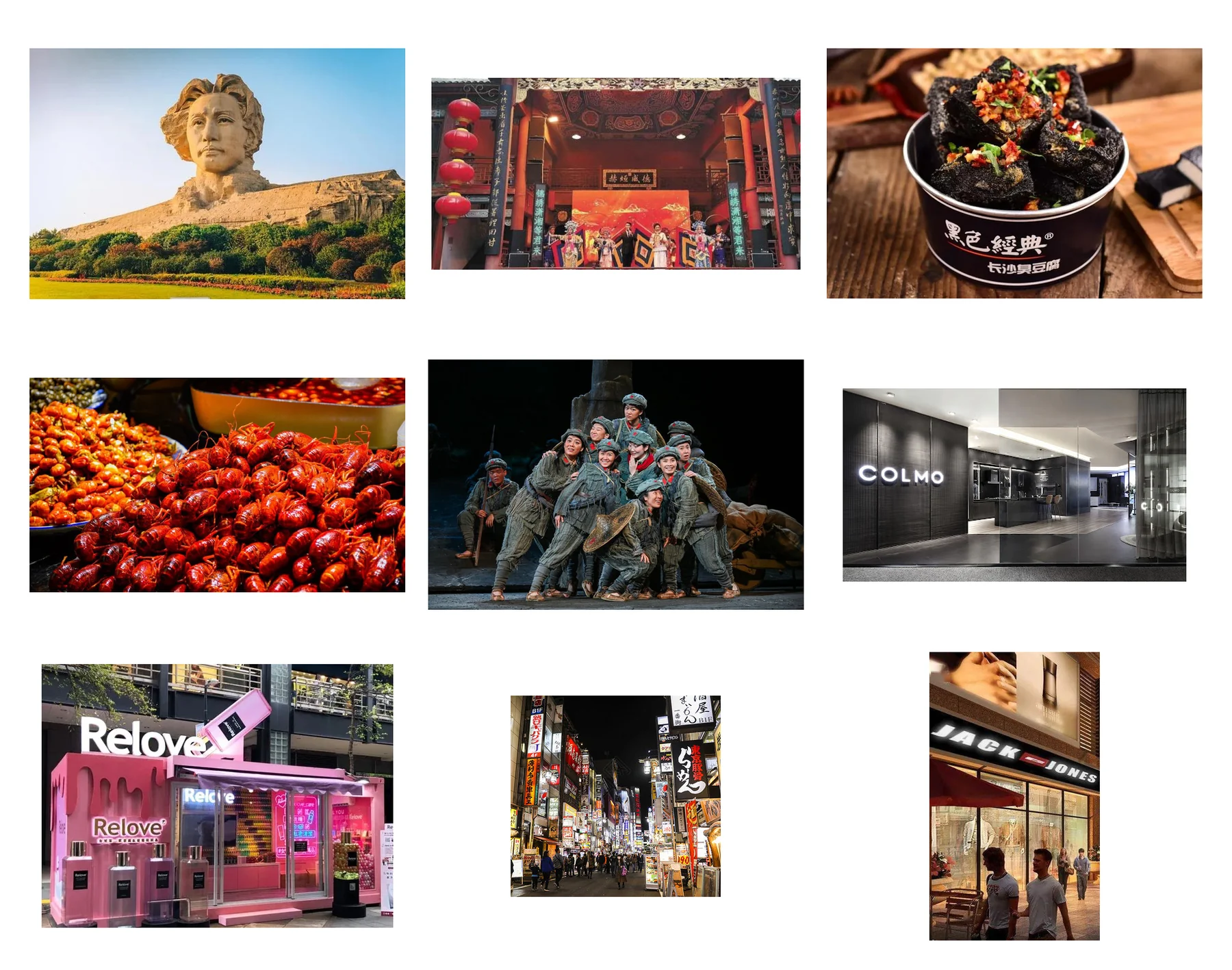
Cultural programming ranges from local food and opera to civic history and everyday street culture, alongside flexible retail and event spaces.
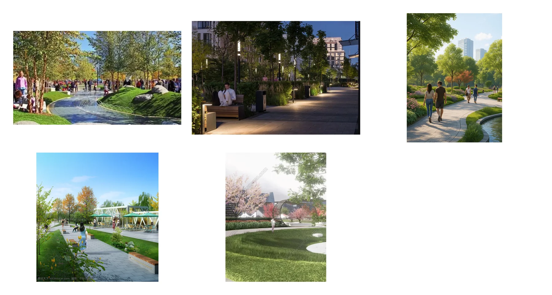
Pocket parks, shaded seating, vertical planting, and open street corners add places to pause and orient within the dense commercial fabric.
04 Masterplan
Organizing the district through movement, structure, grading, planting, and night-time identity
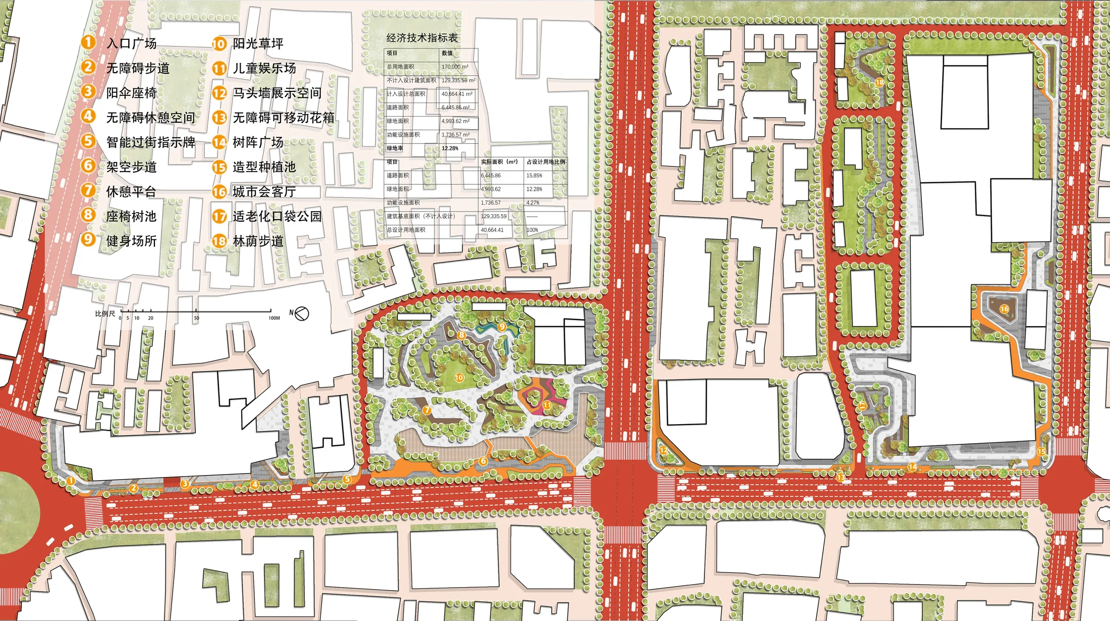
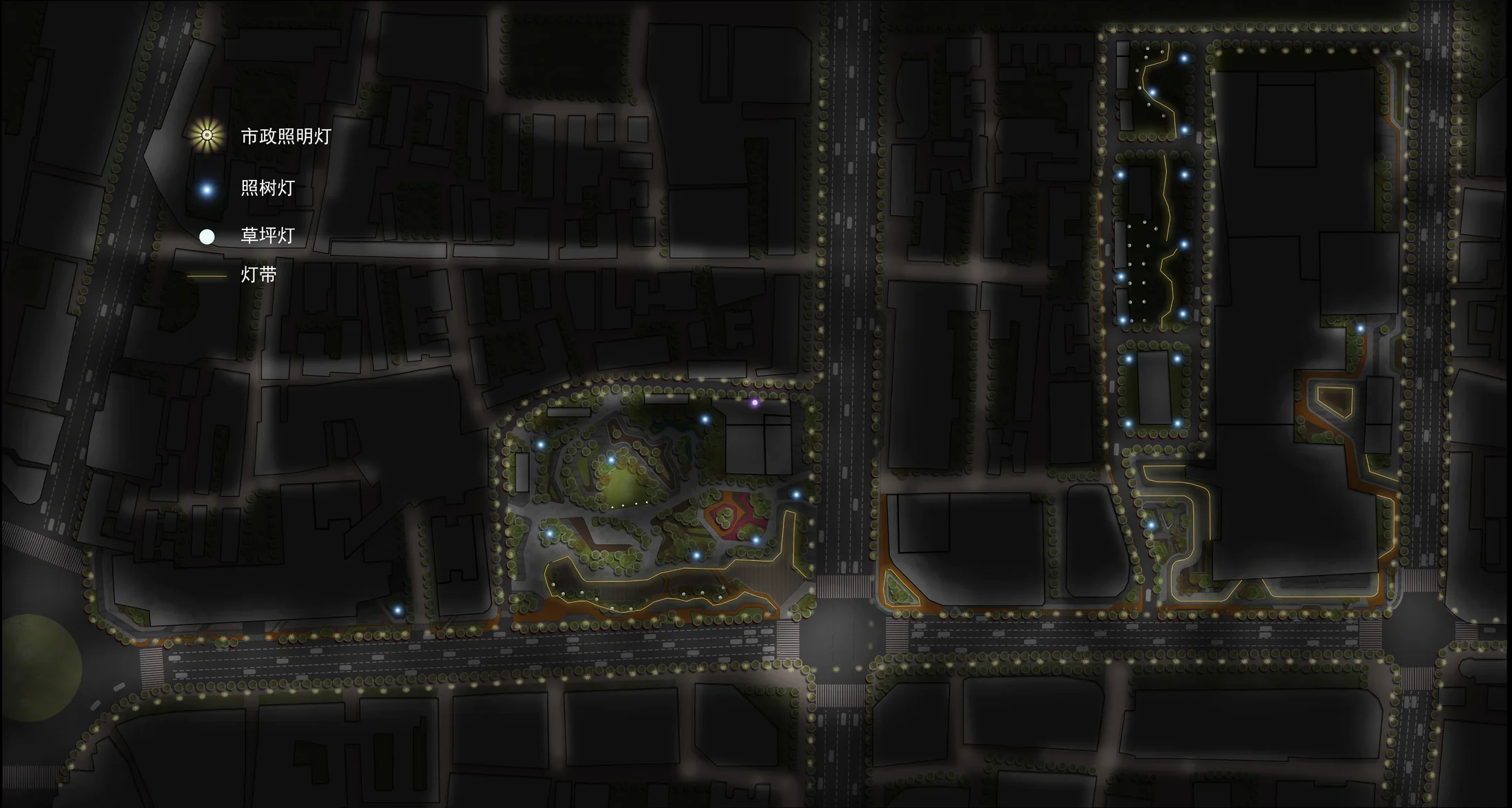
A continuous pedestrian network links commercial frontages, green nodes, and civic squares through pocket landscapes, rest platforms, directional paving, and accessible routes.
Primary street axes, a commercial activity band, and multiple public-space anchors turn fragmented exterior spaces into a legible urban sequence.
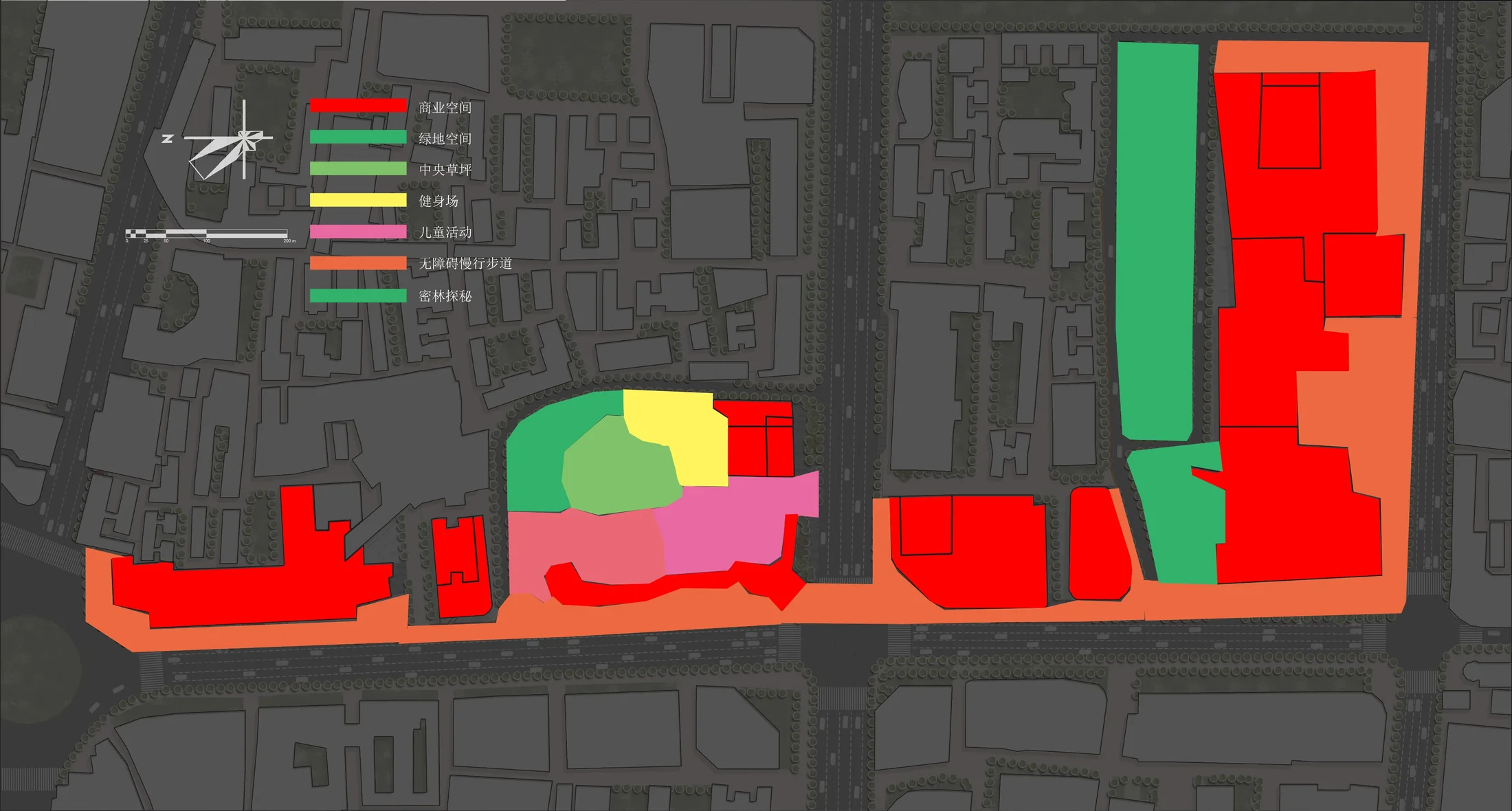
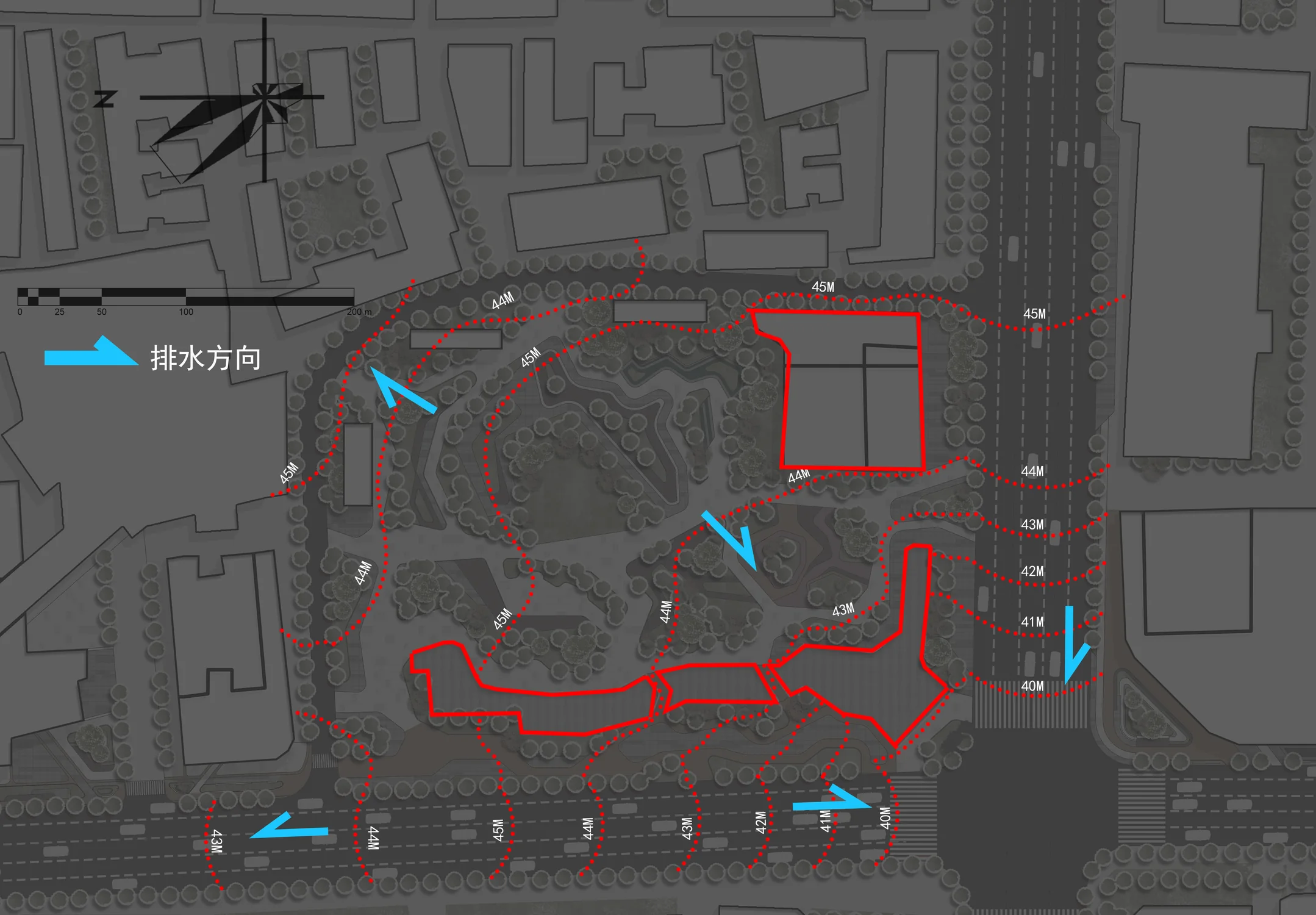
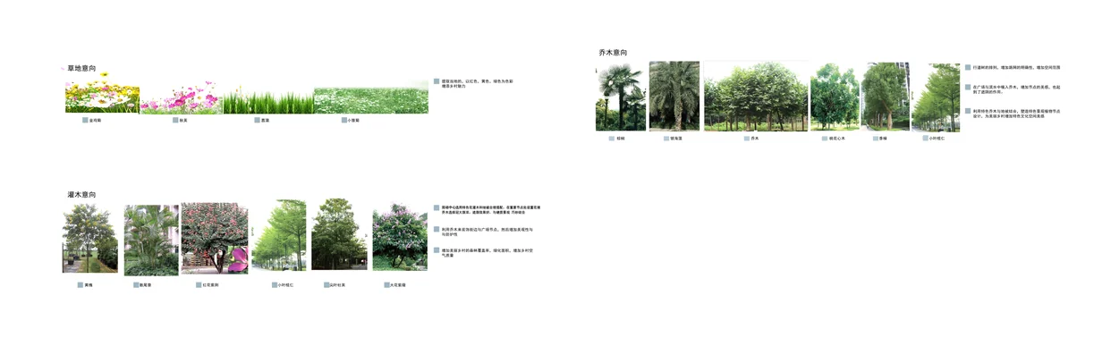
Functional zoning balances movement and pause, while grading, planting, and lighting improve drainage, seasonal character, visibility, and safety.

05 Node Design
Applying accessible movement, planting, and places to pause at IFS and Wuyi Square
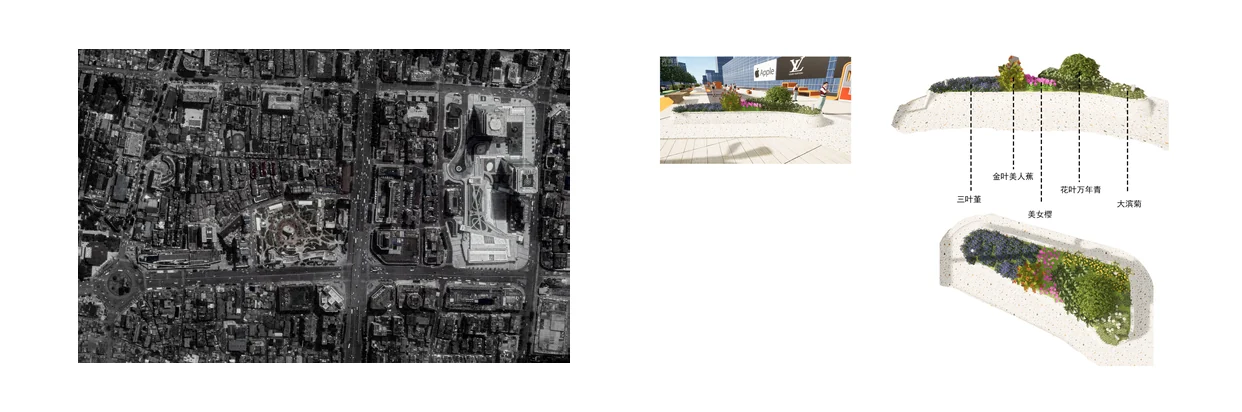
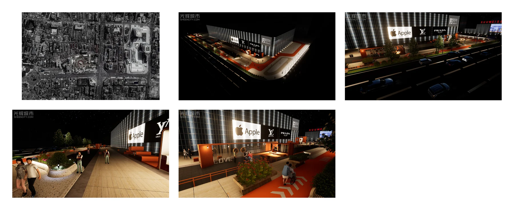
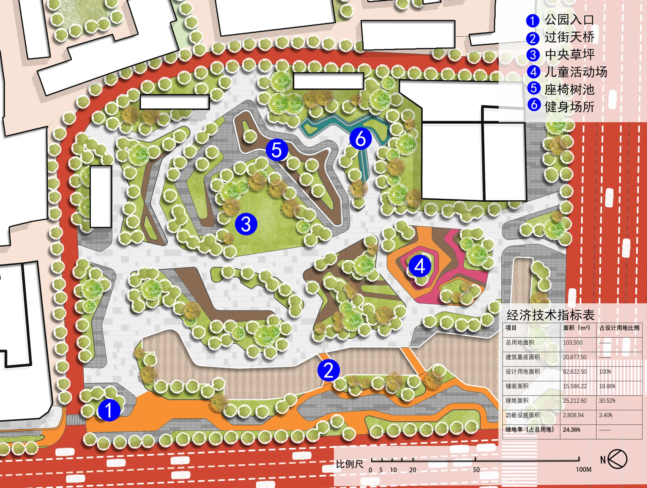
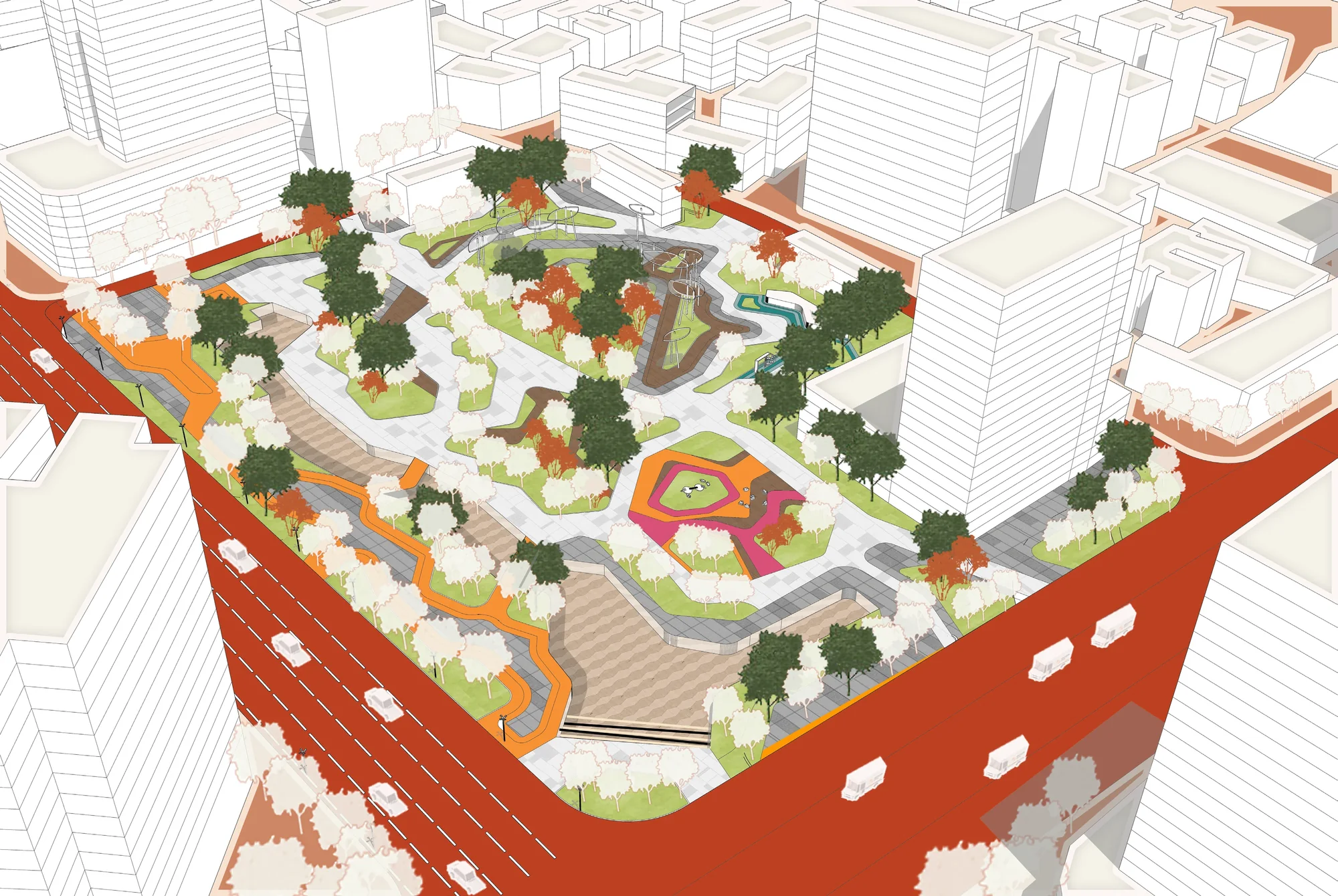
The detailed nodes focus on the IFS street frontage, planting design, and the plan and aerial composition of Wuyi Square.
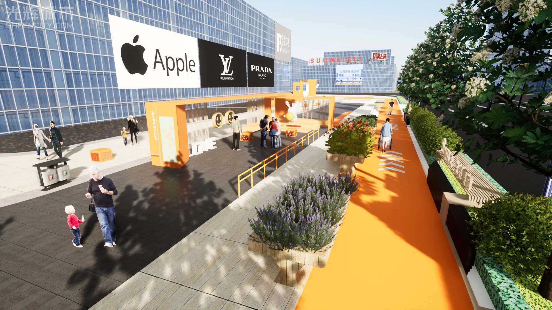
Material changes, commercial edges, and planted boundaries clarify the arrival experience along the IFS frontage.
Wuyi Square becomes the strongest civic node, coordinating activity space, routes, planting, and surrounding building edges.
06 Accessibility & Wayfinding
Supporting independent movement through a continuous network and consistent wayfinding
The accessibility strategy reconnects metro stations, parks, commercial streets, and public spaces as one continuous route system.
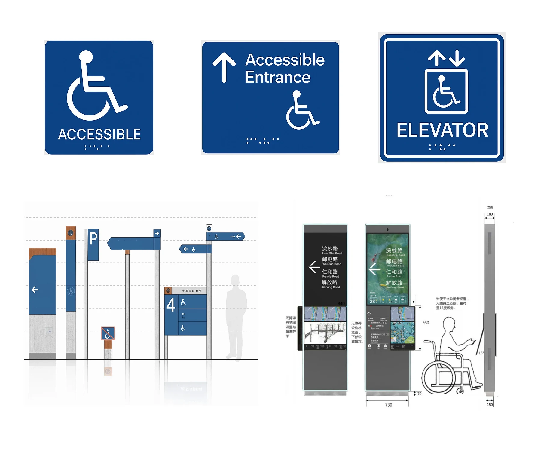
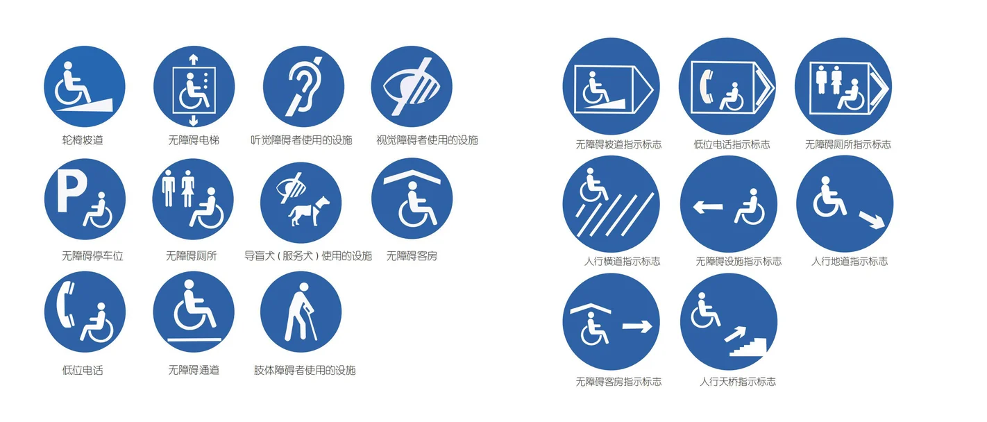
Wayfinding covers accessible entrances, elevators, parking, toilets, wheelchair routes, hearing assistance, tactile paving, and street directions.
Reliable orientation and recognizable information are treated as essential parts of accessibility alongside physical construction.